Hiking Pueblos Mancomunados: Oaxaca's Cloud Forest
Introduction
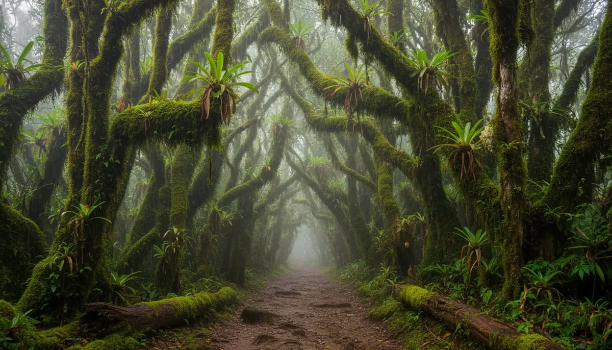
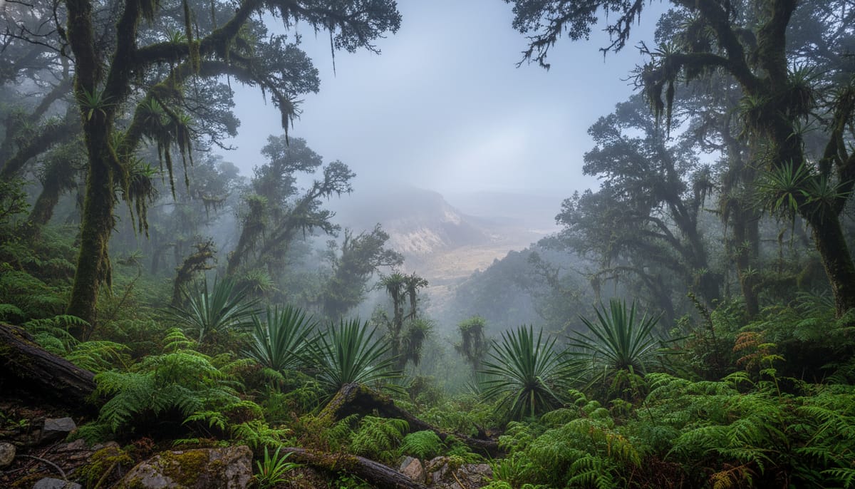
Most travelers arrive in Oaxaca City prepared for heat, mezcal, and dry desert valleys. Few realize that just two hours north—and nearly 2,000 meters higher—lies a completely different world. This is the Sierra Norte, a “Sky Island” ecosystem where the semi-arid cactus landscape sharply gives way to a cold, dense cloud forest.
This region is home to the Pueblos Mancomunados (Commonwealth of Villages), a unique autonomous cooperative of eight Zapotec communities. Unlike most of Mexico, where land often has private owners or federal oversight, these villages operate under shared land rights with no fences between their borders. As noted by Cultural Survival, this communal ownership is the primary reason the forest remains one of the best-conserved biosphere reserves in the country.
This guide is your logistics manual for entering this protected zone. It isn’t just about walking; locals refer to these routes as “Senderos Interpretativos” (Interpretive Trails). The goal isn’t simply to conquer a peak, but to understand the vast biodiversity described by Sierra Norte Expeditions, from ancient agave varieties to elusive pumas.
What are the Pueblos Mancomunados?
To travel here respectfully, you must understand the governance model known as Usos y Costumbres (Customs and Usages). In these eight villages, political parties don’t run the show. Instead, residents are obligated to serve unpaid, mandatory roles known as cargos.
One of these cargos is tequio, or community work. When you see a pristine trail or a staffed tourism office, the person working is often fulfilling their community duty, not working a 9-to-5 job for a salary. This distinct form of governance creates a level of safety and cleanliness rarely seen in other isolated regions of Mexico.
The Commonwealth consists of eight distinct villages:
- Benito Juárez
- Cuajimoloyas
- La Nevería
- Latuvi
- Llano Grande
- San Miguel Amatlán
- Santa Catarina Lachatao
- Yavesía
Traveler Note: Because the tourism staff are rotating community members rather than professional hoteliers, service is warm but rustic. Patience is key.
How to Book Your Trek: Expediciones Sierra Norte
Forget Expedia or Booking.com. The Sierra Norte operates largely offline, and trying to book your entire trip via email can be slow and frustrating.
The Physical Office Strategy
The most reliable way to secure your cabin and guide is to visit the Expediciones Sierra Norte office in Oaxaca City at least one or two days before you plan to leave.
- Location: Calle de Manuel Bravo 210 (Check their official page to confirm, as they have moved in recent years).
- Why In-Person? You can look at the big wall map, customize your route, and pay your deposits in cash.
Allowances and Restrictions
Guides are mandatory. You generally cannot hike point-to-point between villages solo. This rule exists for two reasons: safety (the forest is full of unmarked logging roads) and economics (providing local employment).
Expect to pay approximately 300-400 MXN per hike for the group, plus community access fees. Note that significantly more cash is required for point-to-point logistics.
The Transport Hack
Private shuttles to the mountains can cost upwards of $60 USD (1,200 MXN). For a budget-friendly alternative, ask the office for the schedule of the Autobuses Flecha del Zempoaltépetl or the local colectivos. These usually depart near the Baseball Stadium or Central de Abastos and cost a fraction of the price, roughly 80 MXN. For complete transport details, see our guide on how to get to Pueblos Mancomunados.

Best Hiking Routes & Village Stops
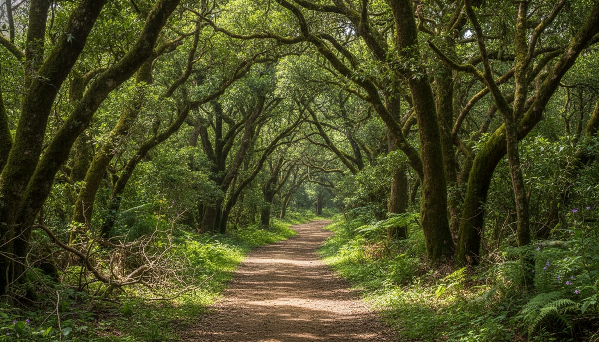
With over 100km of trails following the ancient Caminos Reales (Royal Roads), choosing a route can be overwhelming. Each village has a distinct climate and “vibe.” If you look at a sierra norte oaxaca map, you’ll see a network that allows for multi-day treks.
Pro Tip: The ecotourism office offers a “Luggage Transfer” service. For a fee, a community truck will move your heavy bags to the next cabin while you hike with just a daypack.
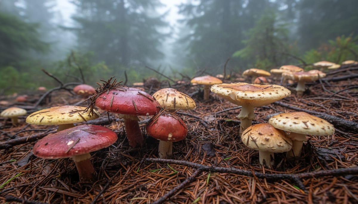
Cuajimoloyas: The Gateway & Mushroom Capital
Sitting at 3,200 meters (10,500 ft), Cuajimoloyas is the highest village in the circuit. It is famous for its bitter cold nights and spectacular panoramas.
- Wild Mushrooms: If you visit during the rainy season (July–September), the forest floor explodes with fungi. The annual Feria Regional de Hongos Silvestres is a major event where you can forage with local experts.
- The Hike: The trek to “Mirador Xi-Nudaa” is steep and breathless due to the altitude. For a gentler walk detailed in our Cuajimoloyas travel guide, ask for the moderate trail to “Ojo de Agua.”
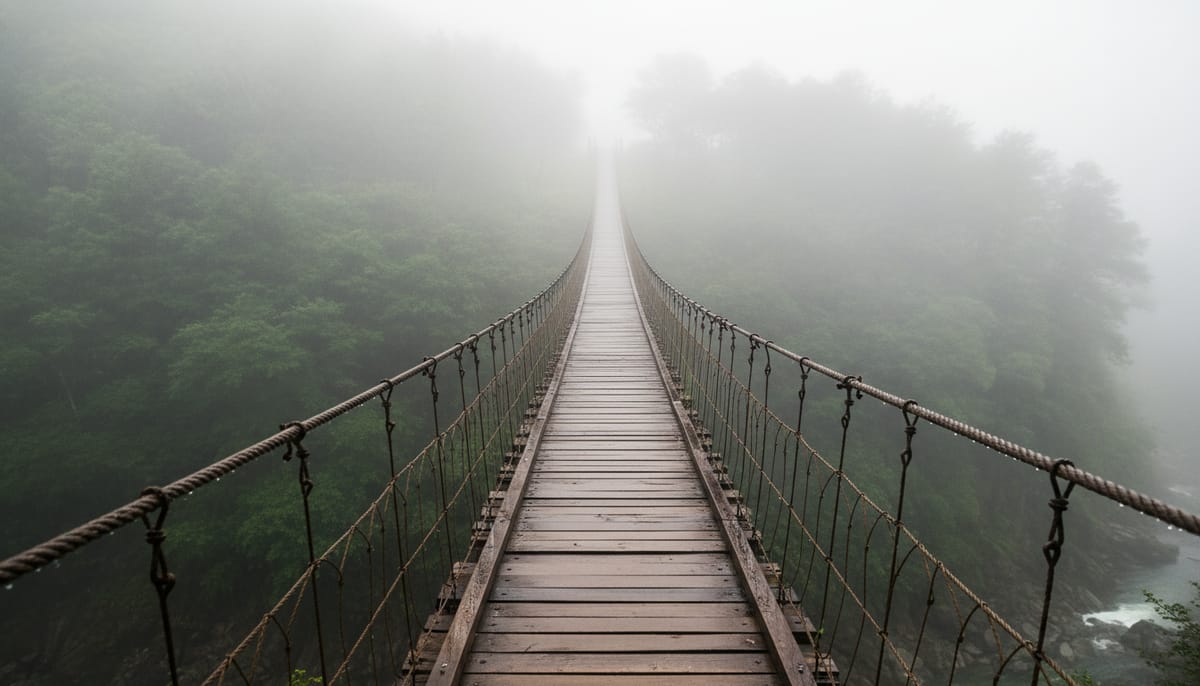
Benito Juárez: Suspension Bridges & Ziplines
This village feels more like an adventure park than its quiet neighbors. It is the most popular stop for day-trippers from Oaxaca City.
- The Bridge: The highlight is a 150-meter suspension bridge hanging over a deep ravine; check our guide to braving the Benito Juárez suspension bridge before you commit to the crossing.
- Weather Warning: This village is notorious for heavy fog. If visibility drops to zero, skip the ziplines and hike to the Criadero de Truchas (Trout Farm) instead.
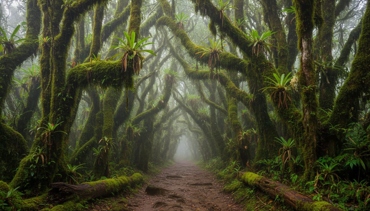
The Classic Traverse: Benito Juárez to La Nevería Hike
If you only have time for one point-to-point trek, this is the one to choose.
- Direction: We strongly recommend hiking from Benito Juárez to La Nevería. This direction keeps the 8-9km trek mostly downhill or flat, making it a moderate experience rather than a grueling climb.
- The Flora: As noted in hiking logs on AllTrails, the trail transitions from high pine-oak forest into mossy cloud forest dripping with epiphytes and bromeliads.
- The Destination: La Nevería translates to “The Icebox.” Before electricity, this village used its natural cold sink microclimate to harvest ice, which was then carried by donkey down to Oaxaca City.
Latuvi: Coyote Canyon & Cozy Cabins
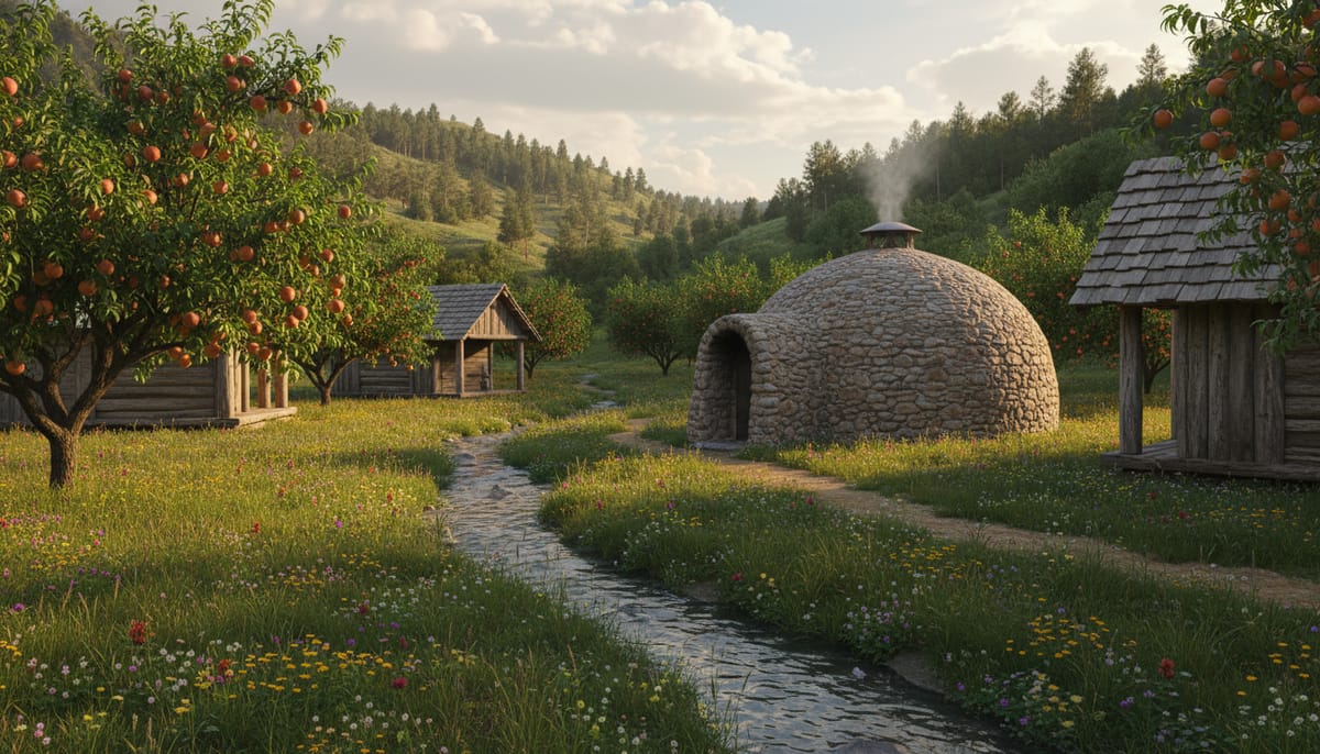
Dropping down to nearly 2,400 meters, Latuvi feels warmer and greener. The vegetation shifts slightly, and it is a prime spot for sleeping in the clouds at Centro Ecoturístico Cabañas Latuvi amongst peach trees and pulque fields. For another memorable stay, explore the Cabañas Llano Grande in the neighboring village.
- The Hack: Latuvi has one of the best riverside Temazcal (steam bath) setups. However, the stones take hours to heat. Actionable Tip: Book your Temazcal the moment you arrive in the village so it is ready by sunset.
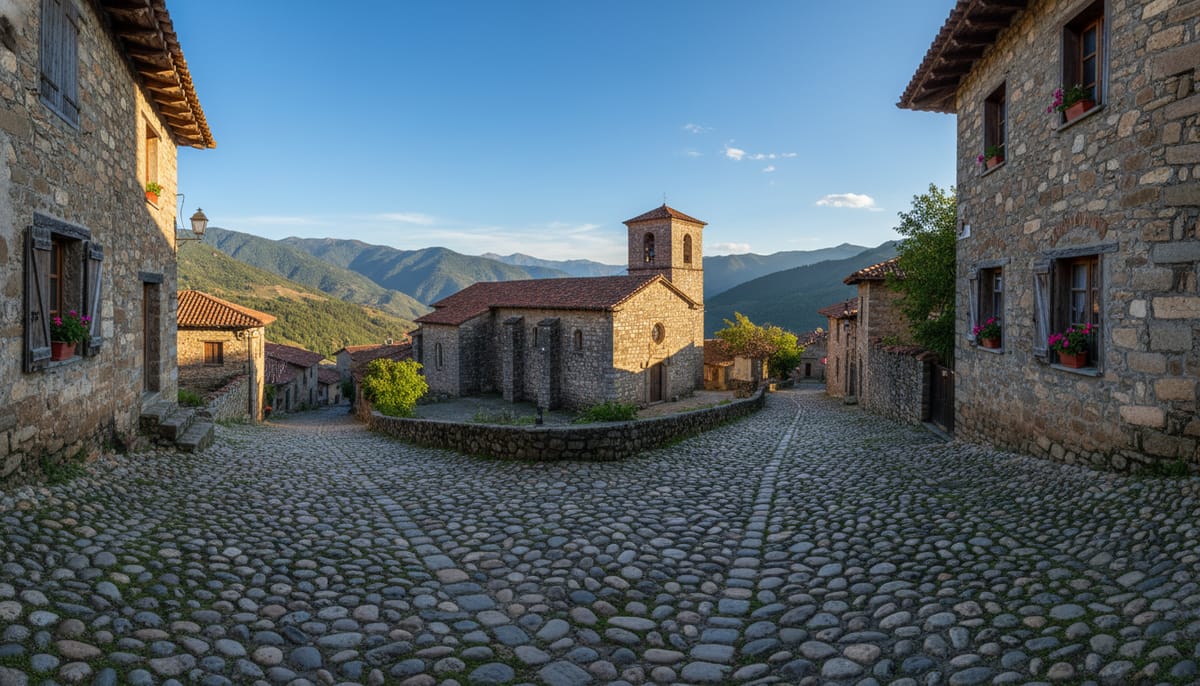
Santa Catarina Lachatao: Ancient Ruins
Lachatao feels ancient. While other villages have a wood-cabin aesthetic, our Santa Catarina Lachatao guide highlights the cobblestone streets and colonial church that give this town an almost European stone architecture.
- Cerro del Jaguar: The main attraction is a hike up to this Zapotec religious center, offering 360-degree views of the Sierra.
- Community Museum: Don’t miss the small museum near the church, housing obsidian and pottery artifacts found by farmers in the surrounding cornfields.
Nearby Excursions: Capulálpam de Méndez
Capulálpam is technically not part of the “Mancomunados” hiking circuit, but it sits right next door. It is designated as a Pueblo Mágico by the federal government, which means better infrastructure, cleaner streets, and yellow quarry stone architecture.
While the Mancomunados follow strict “dry laws” (alcohol is hard to find), Capulálpam has accessible cafes and mezcal. If you want a break from the rustic trails, check out the 10 best things to do in Capulálpam de Méndez, from exploring the local architecture to visiting the Centro de Medicina Indígena Tradicional for traditional cleansings.
Food in the Sierra Norte: Keeping Warm
Do not expect gourmet restaurants. Each village operates a Comedor Comunitario (Community Kitchen). The menu is usually a rotation of fresh trout (trucha), quesadillas, and hot soup.
The absolute star of the region is the Sopa de Hongos (Mushroom Soup).
- The Ingredients: It relies on Hongos de Encino (Wild Oak Mushrooms), garlic, and Epazote—the defining herb that gives our traditional Sopa de Hongos recipe its medicinal, earthy punch.
- The Drink: Mornings here are freezing. You will survive on Café de Olla, coffee brewed in a clay pot with cinnamon and piloncillo (raw sugar).
Essential Packing List for the Cloud Forest
The biggest mistake travelers make is preparing for “dry cold.” The Sierra Norte is wet. The trees catch humidity from the clouds, causing a constant drip even when it isn’t raining.
- Rain Gear: A solid rain jacket or poncho is mandatory year-round.
- Cash is King: There are ZERO ATMs in these villages. Bring enough small bills (20s, 50s, 100s) to cover tips, handicrafts, and meals (approx. 80 MXN each).
- Power: Cabin electricity can be spotty or solar-powered. Bring a heavy-duty portable battery bank for your phone and camera.
Conclusion
Hiking the Pueblos Mancomunados is more than an adventure; it is a direct contribution to one of Mexico’s most successful conservation projects. The forest stands tall today not because of government fences, but because the indigenous communities have built an economy that values trees more when they are vertical than when they are timber.
Start your journey by visiting the office in Oaxaca City or emailing [email protected] to finalize your dates. If you’d rather have logistics handled for you, check Oaxaca adventure tours on Viator for guided Sierra Norte experiences. Whether you choose the high peaks of Cuajimoloyas or the ancient stone streets of Lachatao, you are stepping into a world that few tourists ever see.
Explore all our Sierra Norte of Oaxaca guides for more hiking routes, cabin reviews, and local recipes from this remarkable region.