How to Get to Pueblos Mancomunados from Oaxaca City (2026)
Why Getting There Is Part of the Adventure
The easiest way to get to Pueblos Mancomunados from Oaxaca City is to book transport with Expediciones Sierra Norte, especially if this is your first visit. If you are on a tighter budget, colectivos and the Flecha del Zempoaltépetl bus can get you to Cuajimoloyas or Benito Juárez for a fraction of the cost, but they require more Spanish, more patience, and a firm return plan.
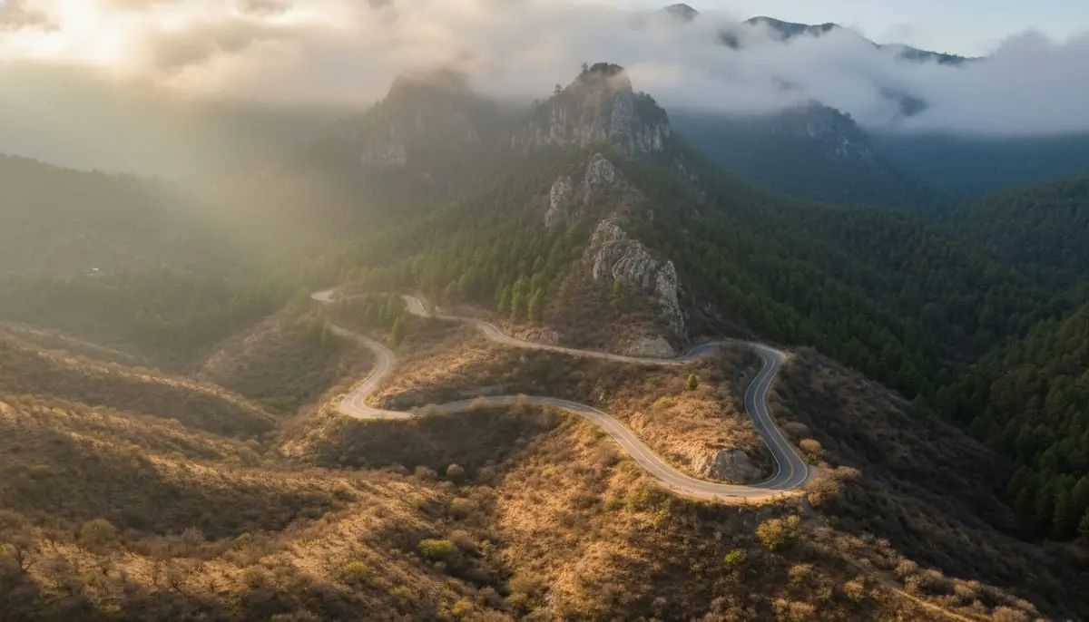
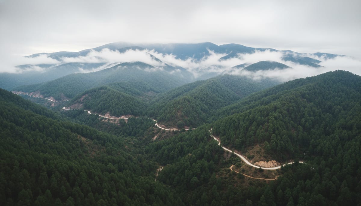
In about 90 minutes, you leave the dry heat of the Oaxaca Valley and climb over 3,000 meters into cool, mist-covered pine forests. The air changes completely. The noise of the city fades. And suddenly you’re in one of the most biodiverse regions in Mexico, surrounded by ancient Zapotec villages where communities govern themselves.
But here’s what nobody warns you about: the Pueblos Mancomunados are spread across two different highways. Taking the wrong road can cost you hours. There’s no Uber in the mountains, no cell service past the valley, and no ATMs once you leave Oaxaca. You can compare car rental prices on RentCars if you want maximum flexibility.
This guide breaks down every transport option with real costs, schedules, and the local hacks that save money and headaches. Whether you’re a solo backpacker catching a $3 colectivo or a family booking a private shuttle, you’ll know exactly how to reach, and return from, the cloud forest.
For trail maps and hiking routes once you arrive, see our complete guide to hiking the Pueblos Mancomunados.
Quick Answer: Best Way to Get to Pueblos Mancomunados
If you just want the short version, this is it:
- Best overall for first-timers: Expediciones Sierra Norte shuttle
- Cheapest option: Colectivo via Central de Abastos or Tlacolula
- Best public transport with a schedule: Flecha del Zempoaltépetl bus
- Best for small groups: Private taxi split 3-4 ways
- Best for multi-village trips: Rental car, but only if you are comfortable driving mountain roads
- Easiest villages to reach from Oaxaca City: Cuajimoloyas and Benito Juárez
- Hardest mistake to recover from: Leaving Oaxaca without arranging your return
If this is your first trip, target Cuajimoloyas or Benito Juárez. They are the most practical gateways, have the best-developed ecotourism setup, and are much simpler logistically than trying to reach the less-connected villages first.
Quick Comparison: All Transport Options
Before diving into details, here’s every option at a glance:
| Transport | Cost (One Way) | Duration | Comfort | Best For |
|---|---|---|---|---|
| Expediciones Sierra Norte shuttle | $45-$75 USD (900-1,500 MXN) | 1.5-2 hr | ★★★★★ | First-timers, families, multi-day treks |
| Colectivo (shared taxi) | $2-$5 USD (40-100 MXN) | 1.5-2.5 hr | ★★☆☆☆ | Budget travelers, Spanish speakers |
| Flecha del Zempoaltépetl bus | $2.50-$4 USD (50-80 MXN) | 2-2.5 hr | ★★☆☆☆ | Budget travelers, no rush |
| Private taxi | $40-$60 USD (800-1,200 MXN) | 1.5-2 hr | ★★★★☆ | Small groups, flexibility |
| Self-drive | $10-$25 USD (200-500 MXN gas + tolls) | 1.5-2.5 hr | ★★★★☆ | Independent travelers, multi-village itinerary |
Important: Every option above is one way. Plan your return before you leave Oaxaca — there’s no calling a ride from the mountains.
Understanding the Hub System (Read This First)
The eight villages of the Pueblos Mancomunados are not on one road. They split between two different highways, and this is where most travelers make mistakes.
Hub 1 — Highway 190 (toward Tlacolula / Mitla):
- Cuajimoloyas
- Benito Juárez
- La Nevería
- Llano Grande
Hub 2 — Highway 175 (toward Ixtlán / Guelatao):
- Latuvi
- Lachatao (Santa Catarina)
- Amatlán
- Yavesía
If you want Cuajimoloyas, you take Highway 190 East and turn toward the mountains at Teotitlán del Valle. If you want Latuvi, you take Highway 175 North toward Ixtlán. Taking a taxi toward Tlacolula when you need Latuvi puts you on the wrong side of the mountain range.
Most first-time visitors head to Cuajimoloyas or Benito Juárez (Hub 1) because they have the most developed tourism infrastructure and easier transport connections. Check our Cuajimoloyas travel guide for what to do once you arrive.
Which Village Should You Aim For?
This is where many guides stay too vague. Your transport plan depends on your first village.
| Village | Best for | Easiest transport from Oaxaca City | Good first trip? |
|---|---|---|---|
| Cuajimoloyas | First-time visitors, short hikes, mushroom season, zipline | Colectivo, bus, shuttle, taxi, rental car | Yes, best starting point |
| Benito Juárez | Suspension bridge, easy overnight, budget hikers | Colectivo, shuttle, taxi, rental car | Yes |
| La Nevería | Cloud forest scenery, quieter cabins | Usually via Benito Juárez or private transport | Maybe |
| Latuvi | Serious hikers, route toward Lachatao, fewer crowds | Shuttle, taxi, rental car, limited public transport | Yes, if you already know your route |
| Lachatao | Camino Real hike, cultural immersion | Shuttle, taxi, limited community bus | Not ideal for a first transport attempt |
| Llano Grande / Yavesía / Amatlán | Longer traverses, multi-day trekking | Best reached through arranged transport or after hiking in | No, unless you already have logistics locked in |
Recommendation: If you are not sure, book Cuajimoloyas. It has the clearest transport logic, the widest range of activities, and the least stressful first-day learning curve.
Option 1: Expediciones Sierra Norte Shuttle (Easiest)
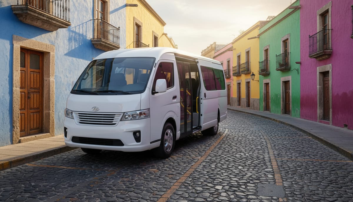
If you want zero stress and don’t mind paying a premium, the official community-run transport is the way to go. Expediciones Sierra Norte coordinates everything: transport, cabins, guides, and meals.
Office location: Calle Manuel Bravo 210 (Interior), Centro, Oaxaca City Phone: +52 951 514 8271 Email: [email protected]
What You Get
- Door-to-door pickup from your hotel or their office
- A driver who knows every mountain switchback
- Help booking cabins, guides, and meals as a package
- The driver calls ahead to the village ecotourism office so they’re expecting you
What You Need to Know
- Book at least 24 hours in advance. This is not a bus service with vehicles waiting. The office calls a driver down from the mountains.
- Cost: $45-$75 USD (900-1,500 MXN) one way, depending on the village. Farther villages like Latuvi cost more.
- In-person booking is best. Email responses can be slow. Visit the office, look at their wall map, and customize your route. They accept cash only.
- Round-trip packages save money. If you book a multi-day trek with cabins and guides, transport is often included or discounted.
Who Should Use This
First-time visitors, families with children, anyone not comfortable navigating local transit in Spanish, and anyone doing a multi-day point-to-point trek. The convenience is worth the premium — especially since the office handles cabin reservations and guide assignments simultaneously.
Planning a multi-day trek? This shuttle pairs perfectly with the routes in our Pueblos Mancomunados hiking guide.
Option 2: Colectivos (Cheapest and Most Authentic)
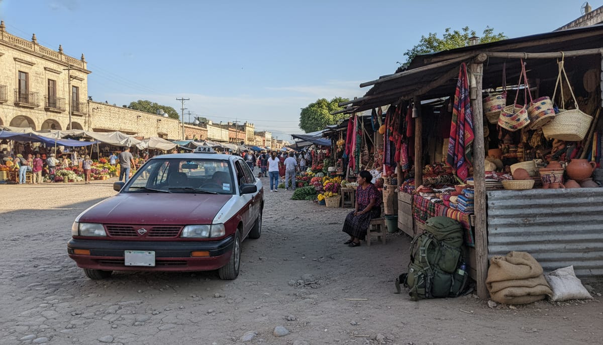
For independent travelers with basic Spanish and a flexible schedule, colectivos (shared taxis/vans) are by far the cheapest option. This is how locals travel.
Getting to Cuajimoloyas and Benito Juárez (Hub 1)
Departure point: Near the Central de Abastos market. Look for maroon-and-white (sometimes yellow) vehicles near the Monumento a la Madre side or the Bodega Aurrera entrance along the Periférico.
Cost: $2-$5 USD (40-100 MXN) per person Departures: Morning hours, typically 7:00-10:00 AM. Vehicles leave when full (usually 4-6 passengers). Duration: 1.5-2 hours to Cuajimoloyas
Safety note: The Central de Abastos is chaotic and can feel overwhelming with a heavy backpack. Head specifically to the taxi stand — don’t wander. If you speak zero Spanish, this option will be challenging. Consider having your hotel write “Necesito un colectivo a Cuajimoloyas” on a card.
The Tlacolula Shortcut
If the Central de Abastos feels too intimidating or colectivos are full, try this local hack:
- Take a colectivo from the Baseball Stadium (Estadio de Beisbol) to Tlacolula — costs $1.50-$2 USD (25-40 MXN), runs frequently all morning
- In Tlacolula’s center, find the camionetas (mountain taxis) heading to Cuajimoloyas — $2-$3 USD (40-60 MXN)
- More frequent departures from Tlacolula than from Oaxaca City
Total cost via Tlacolula: $3.50-$5 USD (65-100 MXN) — still far cheaper than a private shuttle.
Getting to Latuvi and Lachatao (Hub 2)
Departure point: Near the Monumento a Juárez, at the intersection of Highway 190 and Highway 175. This is a different location from the Central de Abastos.
Community bus: A specific bus to Lachatao typically leaves near the Monumento a Juárez in the late afternoon (4:00-5:00 PM) on weekdays. Schedules shift on market days. Call +52 951 515 8232 to verify.
Pro tip: It’s much easier to find transport to Latuvi than to Lachatao. Take a colectivo to Latuvi and hike the historic Camino Real to Lachatao (2-3 hours). You save transport hassle and get one of the best hikes in the circuit.
Option 3: Flecha del Zempoaltépetl Bus (Budget with a Schedule)
For travelers who prefer a set departure time over waiting for a colectivo to fill, the Flecha del Zempoaltépetl bus line runs routes into the mountains.
Departure point: Bus yard near the Central de Abastos, Oaxaca City Typical departure: Around 10:00 AM (schedules change — confirm the day before at the yard) Cost: $2.50-$4 USD (50-80 MXN) Duration: 2-2.5 hours Destinations: Cuajimoloyas, with some routes serving other Hub 1 villages
Drawbacks: Slower than a colectivo (stops along the way), limited departures, and the schedule isn’t always posted online. The bus yard staff speak only Spanish. Show up the day before your trek to confirm the next morning’s departure time.
This is a good option if you want public transport with a fixed schedule rather than the “leave when full” gamble of colectivos.
Option 4: Private Taxi (Flexible, Negotiable)
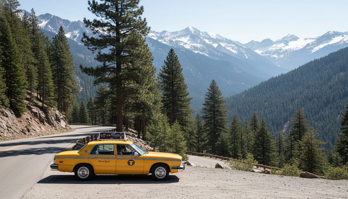
You can hail a standard yellow taxi in Oaxaca City for the trip, but follow these rules:
Negotiation Essentials
- Always agree on a flat rate before getting in. Drivers will not use the meter for this distance.
- Expect to pay: $40-$60 USD (800-1,200 MXN) one way depending on your negotiation skills and which village.
- Tip: Ask your hotel reception to negotiate for you or recommend a trusted driver. They often have contacts who know the mountain roads.
The “No Cell Service” Reality
Signals disappear once you pass Teotitlán del Valle. You cannot use DiDi or Uber to get back. If you want the same driver to return for you:
- Pay 50% up front, 50% upon return
- Set a firm meeting time and location — ideally the Ecotourism Office in the village
- Exchange WhatsApp numbers in case there’s a signal pocket
- Have a backup plan (see Return Transport below)
When This Makes Sense
Groups of 3-4 travelers splitting the cost bring it down to $10-$15 USD per person — barely more than a colectivo with much more comfort. If you’re a small group, this is the sweet spot of price versus convenience.
Option 5: Driving Yourself (Most Flexibility)
Driving gives you maximum flexibility, especially if you plan to visit multiple villages over several days. But the mountain roads demand respect.
Route to Hub 1 (Cuajimoloyas / Benito Juárez)
- Take Highway 190 East from Oaxaca City toward Mitla
- Turn left at the intersection for Teotitlán del Valle / Díaz Ordaz
- From there, the road climbs steeply into the mountains
- Follow signs for Cuajimoloyas (the road is paved to this village)
Driving time: 1.5-2 hours from central Oaxaca Gas + tolls: Approximately $10-$15 USD (200-300 MXN)
Route to Hub 2 (Latuvi / Lachatao)
- Take Highway 175 North toward Ixtlán de Juárez
- Follow signs for the villages (less well-marked than Hub 1)
Driving time: 2-2.5 hours from central Oaxaca
Critical Driving Tips
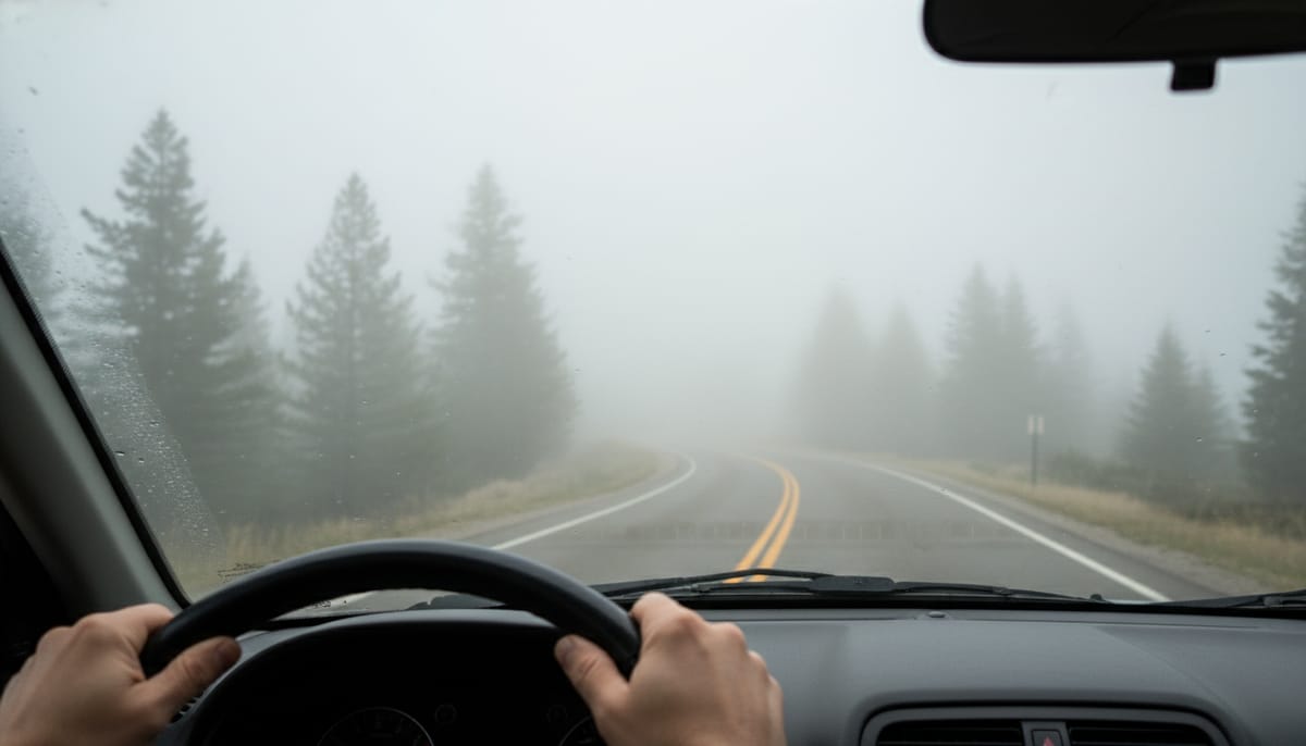
Leave before 11:00 AM. The “Cloud Forest” earns its name every afternoon. Fog rolls in after 2:00 PM and visibility can drop to under 10 meters. Morning drives give you clear roads and incredible views of the valley falling away below.
Vehicle requirements:
- Sedan: Fine for the paved road to Cuajimoloyas
- SUV or high-clearance vehicle: Required for dirt roads between villages (especially Benito Juárez, La Nevería) and mandatory during rainy season (June-September)
- Check your rental car agreement — some Mexican rental companies restrict mountain driving
Download offline maps before you go. Google Maps and Maps.me both work offline. Cell signal dies past Teotitlán del Valle, and there are no road signs at several key forks.
Parking: Each village has a small lot near the Ecotourism Office. It’s informal and free, but don’t leave valuables visible. For more road trip tips in Mexico, see our driving guide.
Getting Back: Return Transport (Don’t Skip This)
This is the section most travel guides forget, and it’s the one that causes the most panic. You cannot call a ride from the mountains. Plan your return before you leave Oaxaca.
Option A: Round-Trip Shuttle
Book return transport with Expediciones Sierra Norte at the same time as your outbound trip. This is the safest, most stress-free option. Cost: same as outbound ($45-$75 USD / 900-1,500 MXN).
Option B: Pre-Arranged Taxi
If you used a private taxi to get up, arrange return at the same time. Pay 50% deposit, set a firm pickup time and location. Most drivers will wait if you’re 15-30 minutes late, but don’t push it.
Option C: Village Ecotourism Office
Once you arrive at any village, the Ecotourism Office staff can help arrange a ride back to Oaxaca. They have phone numbers for drivers and sometimes organize shared transport if multiple groups are leaving the same day. Allow at least 24 hours’ notice — they need to call down to the valley.
Option D: Colectivo Back
Some colectivos make return trips from Cuajimoloyas to the Abastos area in the mornings (typically 5:00-7:00 AM). These are unpredictable — ask at the village store or Ecotourism Office if any trucks are heading down. This is not reliable and should be your backup, not your plan.
Option E: Hike to the Road
If you’re stuck, you can hike down to the main highway (2-3 hours from most villages) and flag a colectivo or bus on Highway 190 or 175 back to Oaxaca. This is the emergency option, not the recommended one.
Bottom line: Book round-trip transport or confirm your return with the village office before you start hiking.
Getting to Oaxaca City First
If you’re coming from other parts of Mexico or internationally, you’ll need to reach Oaxaca City before heading to the mountains.
| From | Method | Duration | Cost |
|---|---|---|---|
| Mexico City | Flight (Volaris, VivaAerobus, Aeroméxico) | 1 hr | $30-$100 USD |
| Mexico City | ADO bus (first class) | 6-7 hr | $30-$50 USD (600-1,000 MXN) |
| Cancún | Flight | 1.5 hr | $50-$120 USD |
| Puerto Escondido | Van/colectivo | 6-7 hr | $15-$25 USD (300-500 MXN) |
| Huatulco | Van/colectivo | 5-6 hr | $15-$25 USD (300-500 MXN) |
| San Cristóbal (Chiapas) | ADO/OCC bus | 10-12 hr | $25-$40 USD (500-800 MXN) |
Oaxaca Airport (OAX) is 15 minutes south of the city center. Colectivos from the airport run $1-$2 USD (20-30 MXN) to the center. A taxi is $10-$15 USD (200-300 MXN).
For a full breakdown of what to do in the city before your mountain trek, read our Oaxaca City travel guide.
What to Know Before You Leave Oaxaca
Book Cabins Before You Go
Even if you plan to improvise the transport, it is smart to lock in your first night’s stay. The ecotourism cabins are community-run, and while the Sierra Norte is not mass tourism, weekends, holidays, and mushroom-festival dates can still fill up. If you book through Expediciones Sierra Norte, they can bundle cabin reservations with transport. If you are building the trip yourself, start with our guides to Cuajimoloyas, Latuvi, and Cabañas Llano Grande.
Cash Is Non-Negotiable
There are zero ATMs in the mountains. Bring enough small bills — 20s, 50s, and 100-peso notes. Drivers, village stores, and community kitchens cannot break 500-peso notes. Plan for these costs:
| Expense | Cost (MXN) | Cost (USD) |
|---|---|---|
| Community entry fee | $50-$100 | $2.50-$5 |
| Guide fee (per group) | $300-$500 | $15-$25 |
| Cabin per night (per person) | $200-$350 | $10-$17.50 |
| Meals (comedor) | $60-$100 each | $3-$5 |
| Temazcal | $200-$400 | $10-$20 |
| Zipline / activities | $100-$300 | $5-$15 |
| Tips (guide + staff) | $100-$200/day | $5-$10 |
Total budget for 2 nights (per person): $500-$1,500 MXN ($25-$75 USD) for village expenses, plus transport costs.
Motion Sickness Prep
The road climbs over 1,000 meters in 45 minutes with constant switchbacks. If you’re prone to car sickness:
- Take Dramamine 30 minutes before departure
- Sit in the front seat if possible
- Keep windows cracked for fresh air
- Avoid reading or looking at your phone
Altitude Awareness
The villages sit between 2,500 and 3,200 meters (8,200-10,500 feet). If you’re coming from sea level:
- Drink extra water starting the day before
- Avoid heavy alcohol the night before (Oaxaca’s mezcal bars are tempting — pace yourself)
- The first hour of hiking may feel breathless; take it slow
- Headaches are common at 3,000m+; bring ibuprofen or aspirin
Connectivity
- Cell signal dies past Teotitlán del Valle (Hub 1) or past Ixtlán (Hub 2)
- No Wi-Fi in most villages (some cabins have very basic satellite internet)
- Download before you go: Offline maps (Google Maps or Maps.me), your e-tickets, emergency contacts in your phone’s notes
- Tell someone your plans. Leave your itinerary with your hotel in Oaxaca or a friend/family back home
For general safety tips while traveling in Mexico, including emergency contacts and practical advice, see our comprehensive safety guide.
Rainy Season Road Conditions (June-September)
During the rainy season, mountain roads can become treacherous:
- Mud and landslides occasionally close dirt roads between villages
- Colectivo and bus schedules become unreliable — drivers won’t risk unsafe roads
- An SUV is mandatory if driving yourself during these months
- The upside: rainy season is mushroom season. The famous Wild Mushroom Festival in Cuajimoloyas happens in late July, and the forest comes alive with fungi
- Book the official shuttle during rainy season — their drivers know which roads are passable
Best Season for the Trip
- Dry season (November-April): Clearest roads, easiest transport, coldest nights (bring warm layers)
- Shoulder (May, October): Fewer tourists, occasional afternoon rain, excellent hiking weather
- Rainy season (June-September): Lush forests, mushroom foraging, but transport complications
- Peak wildflower season: September-October, when the cloud forest is at its most spectacular
What to Pack for the Journey
Beyond normal hiking gear, the transport itself demands specific preparation:
- Cash — small bills, enough for transport + 2-3 days of village expenses
- Dramamine — switchback roads are no joke
- Warm layers — temperature drops 15°C+ from Oaxaca City to the villages
- Rain jacket — the cloud forest drips even when it’s not technically raining
- Portable battery bank — cabin electricity is spotty or solar-powered
- Offline maps downloaded — Google Maps or Maps.me
- Water and snacks — there are no convenience stores on the mountain road
- Sunscreen and hat — the UV at 3,000m is intense, especially on clear mornings
For a complete packing list and gear recommendations, see our Pueblos Mancomunados hiking guide.
Suggested Itineraries by Transport Type
Budget Solo Traveler (2 days / 1 night)
- Morning: Colectivo from Central de Abastos to Cuajimoloyas — $3-$5 USD
- Day 1: Hike to Mirador Xi-Nudaa, explore the village, eat in the comedor. You can explore Oaxaca tours on Viator.
- Day 2: Hike to Benito Juárez, cross the suspension bridge, colectivo back — $3-$5 USD
- Total transport cost: $6-$10 USD
Mid-Range Couple (3 days / 2 nights)
- Day 1: Taxi from hotel to Cuajimoloyas ($40-$60 split two ways = $20-$30 each), hike to Benito Juárez, cabin overnight
- Day 2: Hike Benito Juárez → La Nevería (the classic traverse), cabin overnight at Cabañas Llano Grande
- Day 3: Arrange return transport through Ecotourism Office — $20-$30 each
- Total transport cost per person: $40-$60 USD
Family / Comfort (2-4 days)
- Book everything through Expediciones Sierra Norte — transport, cabins, guides, meals
- Round-trip shuttle: $90-$150 total for the vehicle
- Zero logistics stress — they handle everything, including luggage transfer between villages
- Total transport cost per person (family of 4): $22-$37 USD
Nearby Destinations Worth Combining
If you have extra days, the Sierra Norte connects beautifully with other Oaxaca highlights:
- Mitla — Zapotec ruins with the most intricate stonework in Mesoamerica, on the way to Hub 1
- Hierve el Agua — Petrified waterfalls and natural infinity pools, accessible from the same Highway 190
- Monte Albán — The ancient Zapotec capital overlooking the Oaxaca Valley
- Capulálpam de Méndez — A Pueblo Mágico right next to the Mancomunados circuit, with better cafés and mezcal access
- Teotitlán del Valle — Famous rug-weaving village, right on the turnoff road to Hub 1
You can easily combine 2-3 days in the mountains with these stops for a complete Oaxaca travel experience.
Conclusion
Getting to the Pueblos Mancomunados takes planning, but that is part of what makes this place special. These villages are not mass tourism. They are community-run, intentionally remote, and all the more memorable for it.
If you remember only one thing, make it this: Cuajimoloyas and Benito Juárez are the easiest villages for most travelers, and Expediciones Sierra Norte is the simplest way to reach them from Oaxaca City. If you go by colectivo or bus, leave early, carry cash, and arrange your return before you start hiking.
- Ready to hike? Map your route with our complete Pueblos Mancomunados hiking guide
- Planning overnight stays? Check our guides to Cuajimoloyas, the Latuvi to Lachatao hike, and Cabañas Llano Grande
- Hungry after the ride? Try the traditional Sopa de Hongos recipe you’ll find simmering in every mountain kitchen
- Exploring more of Oaxaca? Our Oaxaca City guide covers the best food, culture, and day trips
- Need adventure ideas? See our Mexico ecotourism and adventure guide and best eco-lodges in Mexico
- Worried about safety? Read our honest Is Mexico Safe guide written from a Mexican perspective