Hiking the Camino Real: The Latuvi to Lachatao Trail Guide
Hiking the Camino Real: The Ultimate Latuvi to Lachatao Trail Guide
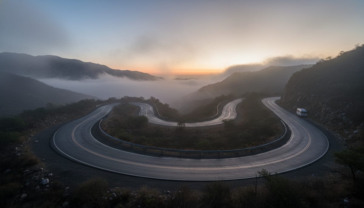
This is not your average forest wander. Hiking from Santa Marta Latuvi to Santa Catarina Lachatao means walking on the “Royal Road,” a historic artery that cut through the mountains centuries before modern highways existed. This pre-Hispanic trade route was paved by Zapotec ancestors and later utilized by the Spanish to transport gold and precious cochineal dye to the port of Veracruz.
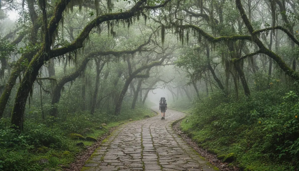
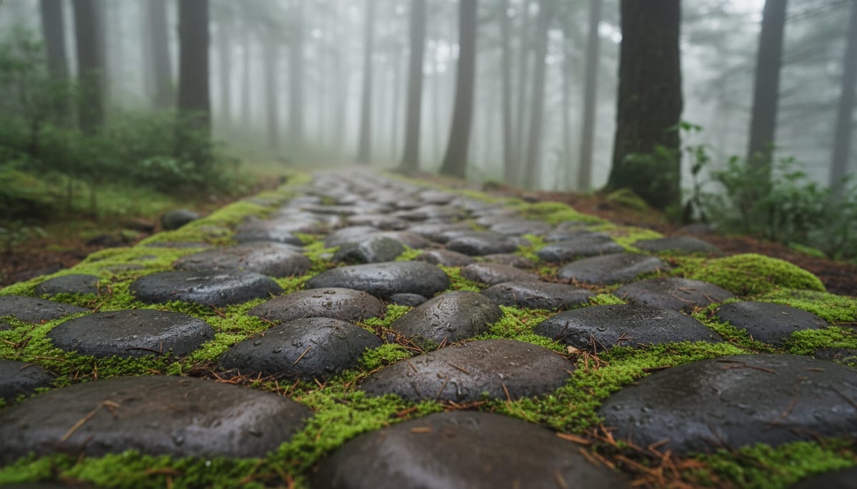
However, the history comes with a physical price. Unlike other soft dirt trails in the Sierra Norte, the Camino Real is famous for its stone paving. While beautiful, these stones are unforgiving on the knees and incredibly slippery when the cloud forest mist rolls in.
Here is the high-level breakdown:
- Distance: ~16km (Variable depending on route)
- Difficulty: Moderate-Hard (Technical surface)
- Scenery: Transition from mossy cloud forest to river valley scrub.
While there are many routes covered in our Ultimate Guide to Hiking the Pueblos Mancomunados, the segment between Latuvi and Lachatao offers the best mix of history and cloud forest scenery.
History of the Camino Real Trail Oaxaca
To understand why your feet might ache after this hike, you have to understand the economy of the 16th century. This trail wasn’t just a path; it was an economic highway.
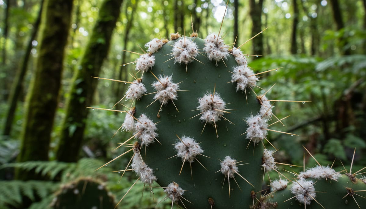
According to historical records curated by Expediciones Sierra Norte, this route served as the primary export vein for Cochineal, the vibrant red dye derived from cactus insects that was once Mexico’s second most valuable export after silver.
While the Spanish paved large sections of it to support heavy mules loaded with cargo, the route itself is much older. Archeological evidence suggests the trail has Zapotec origins dating back over 1,000 years prior to the Spanish arrival. Today, the stretch between Latuvi and Lachatao is recognized on the UNESCO World Heritage Tentative List as one of the best-preserved fragments of the system that once connected the Central Valleys of Oaxaca all the way to the Gulf of Mexico.
Trail Logistics: Latuvi to Lachatao Distance & Difficulty
Many hikers underestimate this route because they view it as a simple point-to-point walk between villages. However, you must prepare for a significant profile inversion.
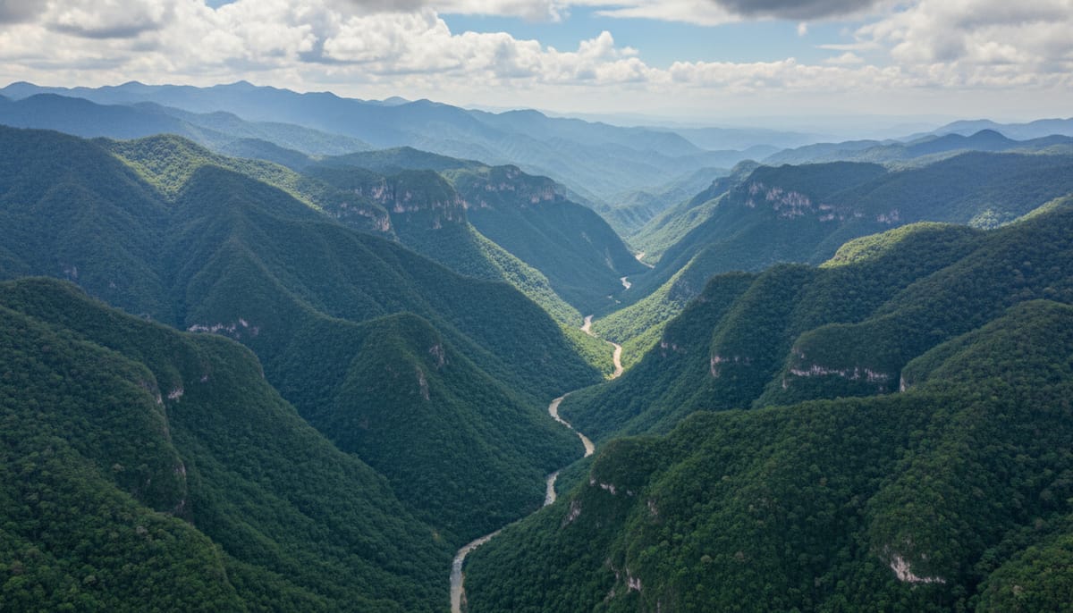
This is not a ridge walk. The route dictates that you descend nearly 800 meters into a canyon and then immediately climb 400 meters back out to reach Lachatao.
- Distance: Roughly 16km (10 miles).
- Time: Plan for 5 to 6 hours.
- Elevation: You start high in Latuvi (2,450m), drop to the Rio Grande crossing (~1,700m), and climb back up to Lachatao (~2,100m).
Safety Warning: Do not attempt to hike this solo. The land is communally owned, and the topiles (community police) patrol these areas. Hiking without a paid permit and guide is viewed as trespassing.
You can analyze the specific topography on this AllTrails map, or review the route analysis on Komoot to visualize the steep descent.
Starting the Hike: Santa Marta Latuvi
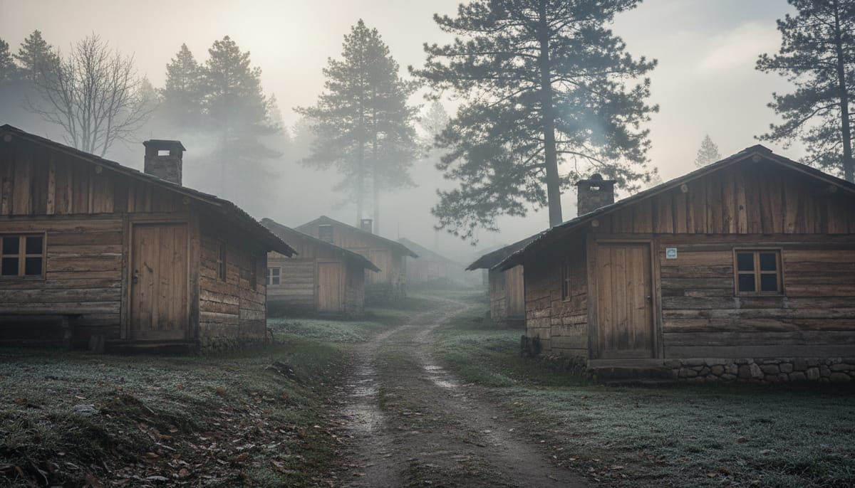
Getting to the start point is the first hurdle. Do not go to the main ADO bus terminal; you will not find transport there.
Community transport (usually a “suburban” van or an older bus) departs from the Monument to Benito Juárez near the baseball stadium, or occasionally from the chaotic Central de Abastos. Departures are limited, often leaving only once a day around 4:00 PM, costing between 60-80 MXN.
Once you arrive in Latuvi, you must head to the “Centro Ecoturístico” office to register. Based on recent traveler reports, you should budget between 350-450 MXN per group to hire the mandatory guide for the crossing to Lachatao.
If you arrived the night before to get an early start, check out our rigorous Cabañas Llano Grande review to see what it’s really like sleeping in the clouds.
The Route: From Cloud Forest to River Valley
This hike takes you through four seasons in a single day.
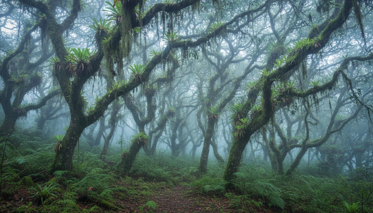
Phase 1: The Goblin Forest
You begin with a steep descent. As you drop in elevation, the damp cloud forest wraps around you. The oak trees here are draped in thick Spanish Moss (paxtle), bromeliads, and wild agave. It feels prehistoric and can be quite chilly in the morning shadow.
Phase 2: The River
At the bottom of the canyon lies the Rio Grande (sometimes called Rio Del Bilie). You will likely cross a rustic bridge, though water levels can rise significantly during the rainy season (June–September).
Important Tip: According to regional hiking experts, the river area is dense with biting insects. It is highly recommended that you stop for lunch about 10 to 15 minutes before reaching the water to avoid being eaten alive while you eat. Also, watch your step—the river rocks are notoriously slippery.
Phase 3: The Ascent
Leaving the river, the landscape shifts dramatically. You enter a drier, pine-dominant forest as you begin the cardio-heavy climb toward Lachatao.
Arriving in Santa Catarina Lachatao
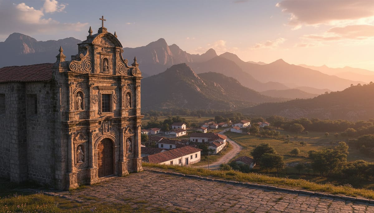
Your arrival in Lachatao is marked by a distinct change in atmosphere. While Latuvi feels rustic and scattered, Lachatao feels like a colonial time capsule.
The crown jewel here is the Templo de Santa Catarina. As noted in the Sistema de Información Cultural, this 17th-century Baroque church is unique because it sits alone on a hill overlooking the square, rather than being flush with the town center.
Logistics Note: The community office handles all lodging payments, but they generally close strictly at 6:00 PM. There are no banks or ATMs here, so ensure you have cash to pay for your room and meals.
Your adventure isn’t over; whether you want to summit Jaguar Hill or explore ancient ruins, the cobblestone streets and colonial church of Lachatao await your exploration.
Essential Packing List for the Sierra Norte
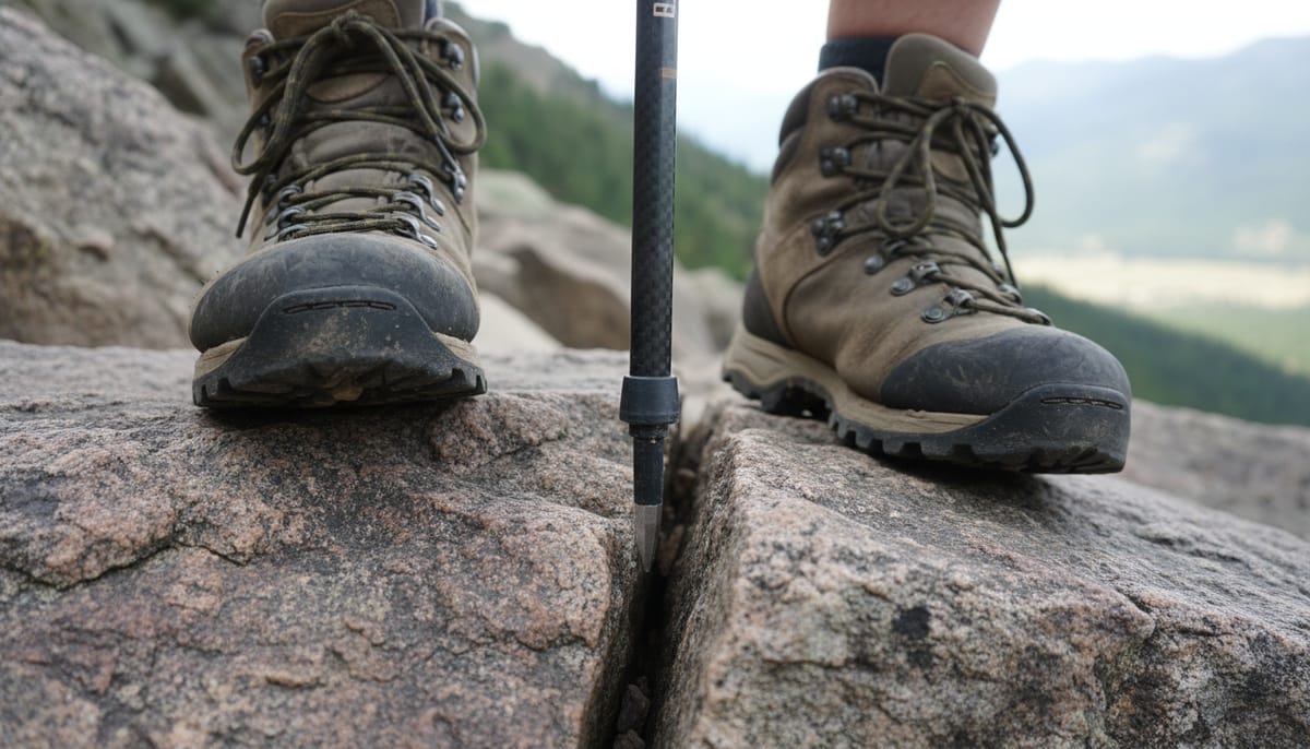
Because this trail is paved with uneven river stones, your gear needs to be specific.
- Trekking Poles: These are a medical necessity for this specific route. The constant impact on the descent can destroy your knees without support.
- Stiff-Soled Boots: Leave the soft running sneakers in the city. You need thick soles (like Vibram) to prevent the angular stones from bruising the bottoms of your feet.
- Cash Strategy: Bring at least 1,500 MXN in small bills. You pay for transport, the guide, water refills, and meals separately, and no one will have change for a 500 peso note.
- Hygiene: Bring your own toilet paper and hand sanitizer; community bathrooms are clean but often unstocked.
Conclusion & Return Logistics
Hiking the Camino Real is a mental and physical challenge, but walking a path that has served as a lifeline for Zapotec civilizations for centuries is a rare privilege.
When it is time to leave, do not sleep in. The community bus back to Oaxaca City is geared toward locals going to work, which means it often departs at 5:00 AM or 6:00 AM sharp from the town center. If you miss it, you are looking at an expensive private taxi ride or a hitchhiking adventure to Ixtlán. You can verify general route connections via Rome2Rio, but always ask the community office for the exact departure time the night before.
Ready to extend your trip? Read our Ultimate Guide to Hiking the Pueblos Mancomunados to find out how to add Cuajimoloyas to your itinerary.